PropertyLine
SiteVẽ ranh giới khu đất (Property Line) tại bất kỳ vị trí nào trên thế giới chỉ bằng cách nhập địa chỉ. Sử dụng bản đồ vệ tinh OpenStreetMap toàn cầu và dữ liệu thửa đất cadastre.
Quick Workflow
Mở công cụ PropertyLine, nhập địa chỉ công trình vào ô tìm kiếm.
Hệ thống định vị vị trí tọa độ địa lý (Latitude/Longitude) và hiển thị ranh thửa đất.
Chọn tọa độ chuẩn (Project Base Point hoặc Survey Point) và bấm Draw Property Line.
Xem bảng khoảng cách và góc phương vị (Bearings) từng cạnh ranh đất.
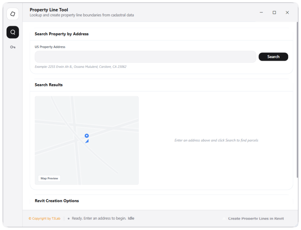
Interface Preview
Detailed Documentation
Property Line - User Guide & Reference
The Property Line utility (Datum category) Automated property line boundary builder. Integrates with the LightBox API to search land parcels by address and retrieve parcel boundaries coordinate geometry. Converts geographic WGS84 coordinates (Latitude/Longitude) to local Revit feet projections and models property line curves automatically..
1. Overview & Key Capabilities
The Property Line tool is designed to improve workflow efficiency by automating standard tasks. Key capabilities include:
- Automated property line boundary builder.
- Integrates with the LightBox API to search land parcels by address and retrieve parcel boundaries coordinate geometry.
- Converts geographic WGS84 coordinates (Latitude/Longitude) to local Revit feet projections and models property line curves automatically.
2. Detailed Step-by-Step Usage
Follow these instructions to use the tool in your active Revit session:
- Launch Property Line from the Modeling panel.
- Enter a physical street address or search query in the search bar.
- Preview the parcel polygon boundary on the interactive map canvas.
- Set rotation offsets and local coordinate projection origins.
- Click Build Property Line to generate Revit property line elements.
3. Technical Specifications & Under the Hood
Revit API Integration
- Key API Components:
PropertyLineandPropertyLineSegmentcreation. Integrates coordinate transform matrices (WGS84 lat/long to State Plane coordinate systems). - Transaction Handling: All modifications are packaged into a single Revit API transaction. If any error occurs, the changes are rolled back automatically to preserve model integrity.
[!TIP] Best Practice Tip: Verify the project base point coordinate offsets before placing property lines from geographic data coordinates.